
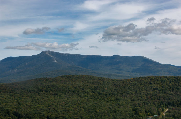

the campus Natural Area Blue Trail
on Saturday during a crisp fall afternoon. (Photos by Matt Heller)
By Finn Hopkins
In a state known for the natural beauty of the green mountains, experiencing all that the outdoors has to offer seems almost unavoidable. “Getting outside makes me feel relaxed and refreshed. It a nice way to take a step back from technology, homework and class,” said Ruby Aldrich ’19. While many students spend time in the Gilbrook trails on campus, there is a variety of other nearby trails to mix up the scenery for hiking, running or dog walking. With prime foliage covering the state, be sure not to miss out on the leaf peeping season. If you’re looking for a change of scenary spend some time exploring the following trails.
Salmon Hole
Location: Access from Intervale Road
Distance from campus: 2 miles
Length: 0.6 miles
A short trail that’s close to campus, Salmon Hole River Trail runs along the Winooski River for just over a half mile. According to Molly Peters, head coach of the women’s cross country team, students can walk about a mile down the streets of Winooski to get onto the trail systems. The trailhead parking lot is on Riverside Avenue in Burlington, just 200 yards after the bridge to Burlington. Dogs are also able to use this trail but must be kept on leash.
Sunny Hollow Park
Location: behind Costco, Colchester
Distance from campus: 3.1 miles
Length: 10 miles
For a longer trail check out the 10 miles of trails that make up Sunny Hollow. Coach Peters describes it as being very safe and great for running and mountain biking. Sunny Hollow Park has both dirt and rocky trails, as well as multiple streams and bridges, which are a nice place to pause. The trails are narrow and hilly, and there are wet areas and sandpits. There is parking across from Vermont SportsCar on Hercules Drive. A gravel trail begins across from the parking lot, and leads into the wood covered trail.
 Red Rocks
Location: Central Ave, South Burlington
Distance from campus: 5.5 miles
Length: 2.7 miles
A little further from campus, is the Red Rocks Park Loop in South Burlington. The loop has beautiful views of Lake Champlain, the Adirondacks, Camels Hump, and Mount Philo. The trail is dirt and is very wide. To get here, take Shelburne Road (Route 7) in South Burlington just south of the intersection with I-189, and turn west onto Queen City Parkway. After 0.5 miles, turn left onto Central Avenue. The parking area and park entrance will be visible on your right.
 Woodside Natural Area
Location: Woodside Drive off Route 15
Distance from campus: 1 mile
Length: 1.5 miles
To get here from campus by foot, follow the paved road down the hill from behind the The View, across Route 15. Keep left until you reach the compost facility, and continue left. Follow the signs through the woods and you’ll arrive at the trail. According to Declan McCabe, professor of biology, this trail is great for running as well as snowshoeing and nordic skiing in the winter. Both the access trail and the Woodside trail are a mile and a half long each.
Aldrich makes an effort to spend a few moments in nature at least four times a week. “Having so many nearby trails makes it easy to spend some time exercising and exploring the woods, which makes me feel healthy and refreshed. The days that I don’t go outside, I feel stir crazy.”